Earth never stops! Find out what exciting developments are happening from around the world.

The untapped reservoir of hot water beneath UK cities could provide green energy for millions of homes.
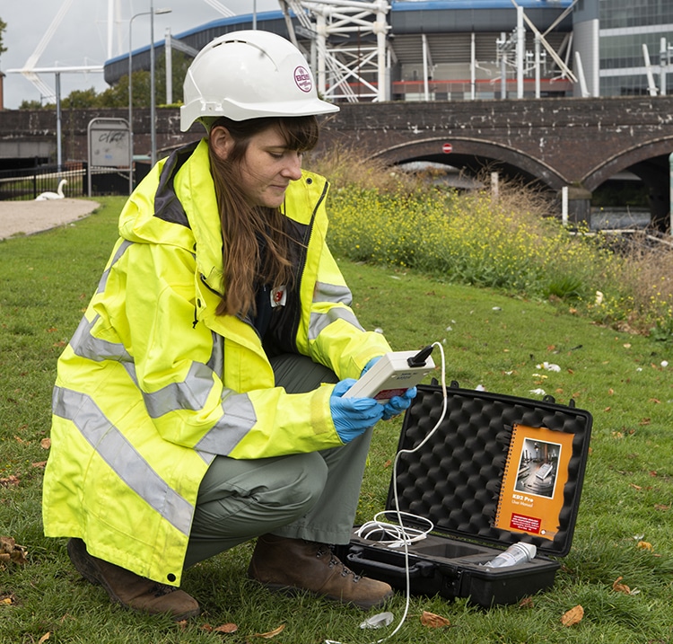
A pilot scheme in Cardiff shows that it is possible to heat buildings using groundwater beneath the Earth’s surface. If this technology was rolled out across the UK it could provide green energy for millions of homes and small businesses.
The UK has set an ambitious target of reducing its net greenhouse gas emissions to zero by 2050. The solution may be lying right under our feet; there is potentially enough geothermal energy under the Earth’s crust to provide for all our power needs for billions of years, all we need do is harness it.
If you were to dig a big hole straight down into the Earth, you would notice the temperature increasing the deeper you go. That’s because the inside of the Earth is full of heat – emanating from the planet’s core, and the radioactive decay of uranium, thorium and potassium in certain types of rocks. Unfortunately, most of this heat is inaccessible; but tapping just a fraction of it would make a substantial contribution to reducing greenhouse gas emissions.
One option is to drill deep down into rocks to access hot waters directly. In most regions of the UK this would be madness, as the drilling costs would be astronomical. However in the south west of England, where the crust contains large amounts of heat producing granites, it may be feasible, and a geothermal power plant is currently under development at United Downs.
However the risks from drilling deep boreholes into the Earth’s crust are not yet fully understood, with some fearing the impacts on seismic activity. BGS scientists in Cardiff believe that a more promising route lies in accessing shallow groundwater just meters beneath the ground.
To read more about this, check out the Planet Earth website.

In November 2019 and February 2020, severe floods wreaked havoc across much of the UK. Given the huge costs to people’s lives and livelihoods caused by floods, one may wonder why more cannot be done to prevent flooding, or at least to warn people when a flood is expected.
So how can scientists predict when and where a flood is likely to occur? The first thing you need to get right is the weather forecast – you need to know how much rain is going to fall and in what areas. However, whilst weather predictions have come a long way in the past few decades – today’s three-day forecast is as accurate as a 24-hour forecast was in the 1990s – they are never perfect.
In addition to a weather forecast, you also need to know a great deal about the landscape of local areas, so that you can predict the path that rainfall will take.
“For every single raindrop that falls you need to track it and know where it goes,” says Professor Hannah Cloke OBE. “There are billions upon billions of different routes through the landscape that a single raindrop might take, for example it could soak into the ground, or runoff into a lake or a river. Based on our knowledge of the landscape and environmental conditions, we have to model all these possibilities to predict how much rain will flow into rivers from above and below ground.”
This complexity goes some way to explaining why, despite the advent of supercomputers and the hard work of some of the world’s brightest scientists, we are still some way from being able to predict exactly when and where a flood will hit.
Check out the IMPREX game where you can look at the use of forecasts to prevent flooding.
Participants have to be ready to protect their city and its inhabitants from flooding by interpreting forecasts and making decisions about what level of flood defences to deploy